If you are on the look for an aesthetic worldwide topographic map (with contour lines, …) OpenTopoMap is worth a “visit” (https://opentopomap.org). With “XYZ-Connections” it is also a quite usefull basemap within QGIS projects.
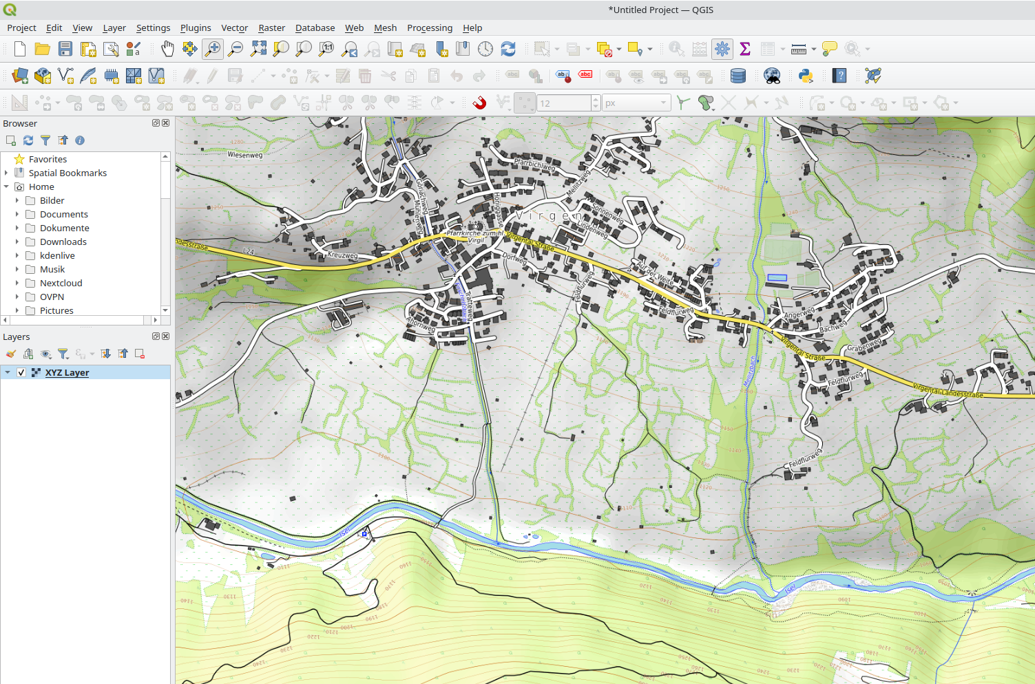
If you are on the look for an aesthetic worldwide topographic map (with contour lines, …) OpenTopoMap is worth a “visit” (https://opentopomap.org). With “XYZ-Connections” it is also a quite usefull basemap within QGIS projects.
Heureka, Fedora 38 Beta with Kernel 6.2.x supports RTL8852BE Wifi and Bluetooth out of the box 🙂 The manual work like described in Kubuntu 22.04 on Lenovo ThinkBook 14 G3 ACL is not necessry anymore.
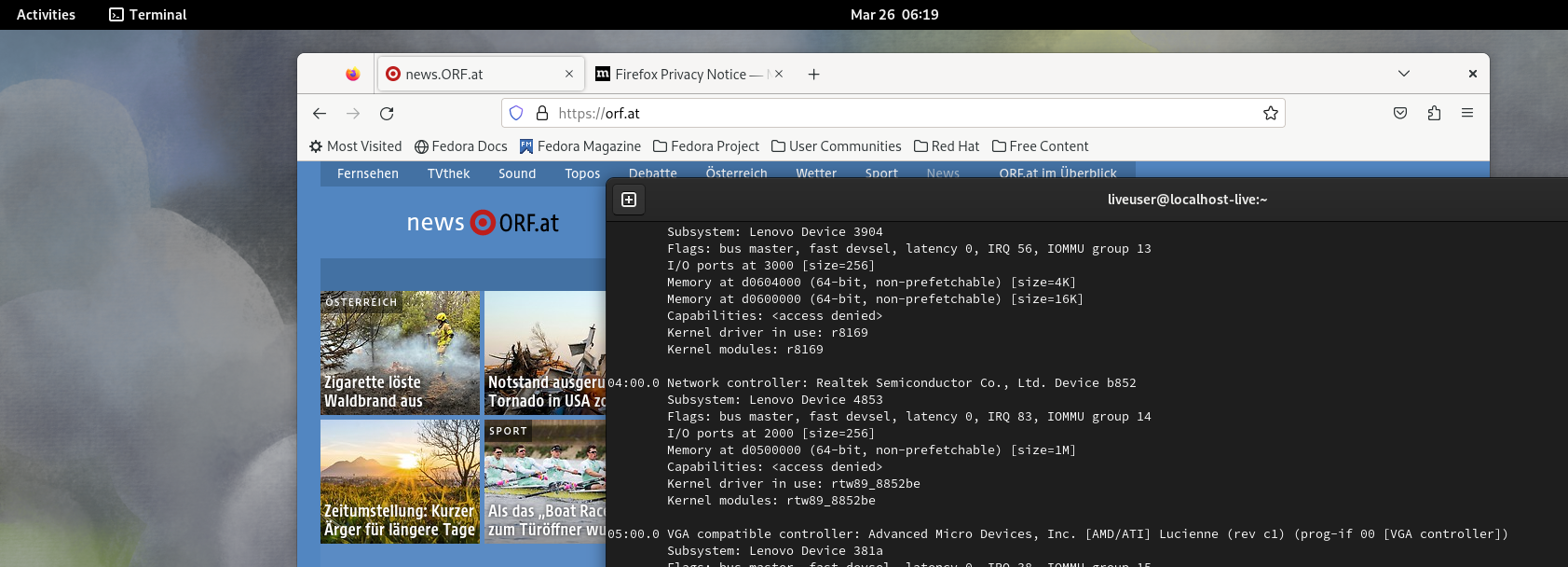
The Lenovo ThinkBook 14 G3 ACL is a well equipped device with a Ryzen 7 CPU and decent built-quality. The keyboard has a backlight feature, but not the quality and key drop a typical ThinkPad keyboard has – and the typical ThinkPad Trackpoint is missing 🙁 Installing Linux (Kubuntu 22.04, Kernel 5.15) works well if there would not be the Realtek RTL8852BE WiFi with integrated Bluetooth.
Kubuntu 22.04 on Lenovo ThinkBook 14 G3 ACL weiterlesenThanks to the FOSS4G speech “FOSS4G – Cloud optimized formats for rasters and vectors explained,” I got first contact with the vector-format “FlatGeobuf” – and surprise also QGIS supports it 🙂 . That was an obvious starting point for testing it with some vector data and a poor network connection (~16 MBit).
FlatGeobuf – vector performance for the cloud (tested with QGIS 3.24) weiterlesen
Since the end of october 2021 the meteorological service of Austria (ZAMG) provides datasets for free on the “ZAMG Data Hub“.
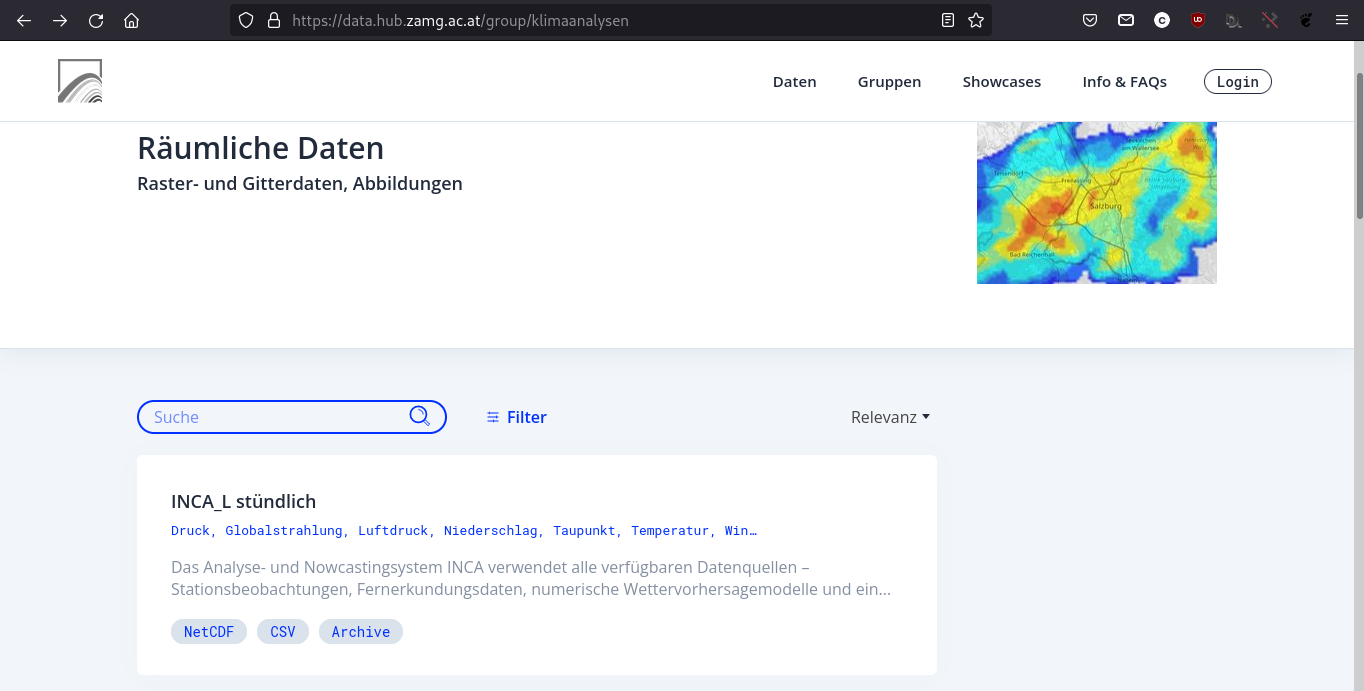
In addition to typical meteorological data from weather-stations, also a category with “spatial data” is available – so let’s have a look on the data with QGIS and the NetCDF datasets with timestamps.
Using Austrian weather&climate data with QGIS – ZAMG Data Hub weiterlesen
Altough the HP Elitebook 745 G2 (AMD Hardware) has some age, it’s a nice working-tool with good built-quality and mine works fine after 6 years intense use. BUT: HP reports the most recent BIOS versioned 1.48 – the BIOS internal update tool reports no update available based on V 1.44

HP Elitebook 745 G2 (AMD) – Reports no BIOS-Update to 1.48 available weiterlesen
Just for fun I gave Fedora and Gnome with version 34 a try again 🙂 One of the first things to do as a geoscientist has been the installation of QGIS… because of the not always up-to-date repo versions (and COPR), I selected the Flatpak-version… but got 3.16 LTS alltough I expected it to be 3.18.2 :-/ What I did not know, Flathub encapsulates 2 versions in one “Repo”.
Fedora and QGIS-Flatpak – LTS versus recent version weiterlesen
Today Microsoft released the first Dev-Version of its Edge Browser for Linux.
Let’s have a first look on it within Kubuntu 20.04

Microsoft Edge (Chromium) Linux – first glimpse on it weiterlesen
Good news for all users and fans of Geopackage – with ArcGIS 2.6 ESRI made it possible to edit features stored in a geopackage database directly 🙂 So after QGIS making geopackage it’s default “geodatabase”, ESRI also supports it including editing features.
I did a first workflow and ArcGIS Pro 2.6 did it’s job editing features stored in a geopackage 🙂
ArcGIS Pro 2.6 falls in love with (editing) Geopackage 🙂 weiterlesen
The nature observation platform observation.org provides a SQLite-dump of your observations. As a geospatial nerd it is obvious to have a deeper look on the database and how the location of the observations is stored… and to think one step further: Make a Spatialite database of it and use it directly in QGIS or ArcGIS.
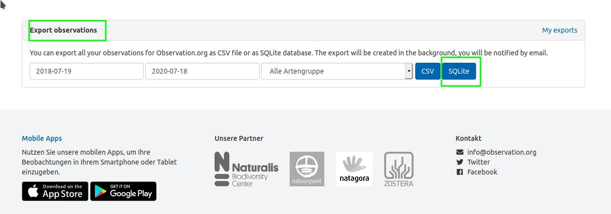
From observation.org SQLITE dump to QGIS with Spatialite weiterlesen