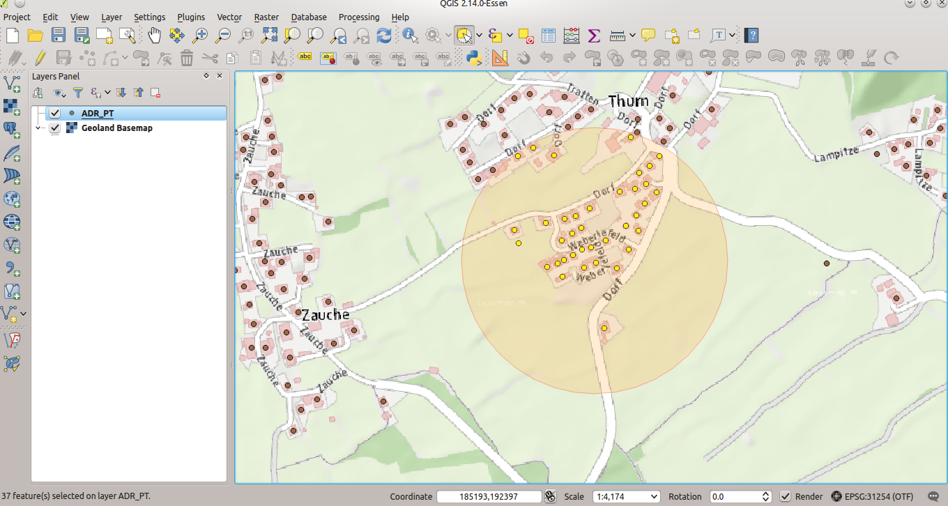
After importing geodata from the GIS to MongoDB and creating a spatial index (part 1), the exciting (spatial) adventure starts. With “normal” (relational) databases and their spatial extensions (Oracle spatial, PostgreSQL/PostGIS, SQLite/Spatialite,…) a lot of spatial queries and geoprocessing are possible. So let’s try to find out which adresses have to be evacuated 250m around some “event”…
MongoDB (V 3.2) already supports basic spatial queries like intersections, proximity and some more.
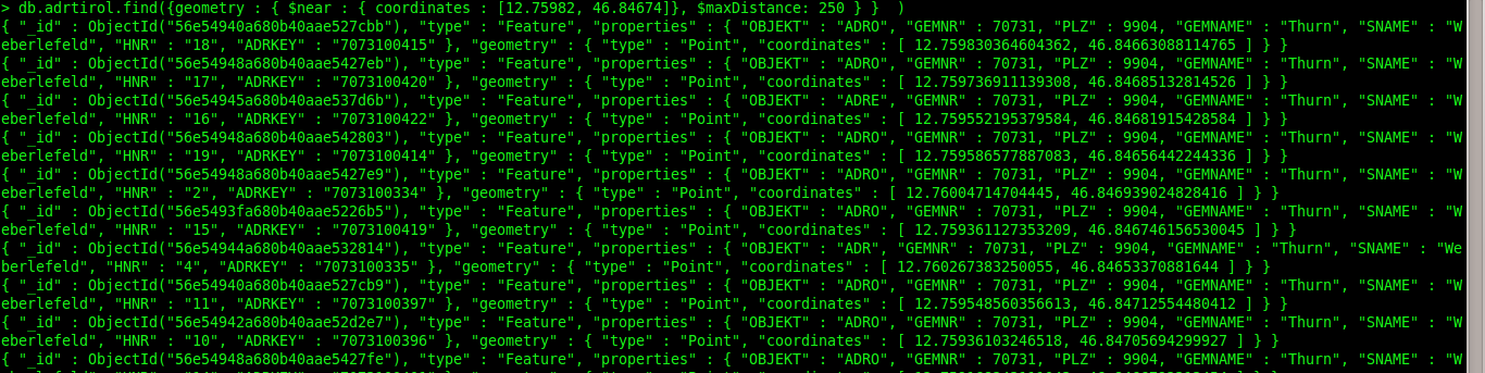
Our “event” takes place at 12.75982E/46.84674N and all objects within a distance of 250m have to be evacuated:
> db.adrtirol.find({geometry : { $near : { coordinates : [12.75982, 46.84674]}, $maxDistance: 250 } } )
Instead of $near (Proximity) we could also use the $geoWithin-Operator (Distance in radians!):
> db.adrtirol.find({geometry : { $geoWithin : { $center : [[LON,LAT],Distance in radians]}, } } )
In case we want to know the distance of each object to the event:
> db.runCommand({ geoNear: "adrtirol", near: [12.75982, 46.84674], spherical: true, maxDistance: RADIANS!})

MongoDB’s documentation on geospatial query operators is very helpful. Browse through it and you will find some nice geo-features within MongoDB. MongoDB as a direct spatial datasource (incl. editing) in GIS would be an important step towards the classical Desktop-GIS-community. In some scenarios MongoDB is a performance-beast, so maybe it could be interesting for organizations with large amounts of spatial data.