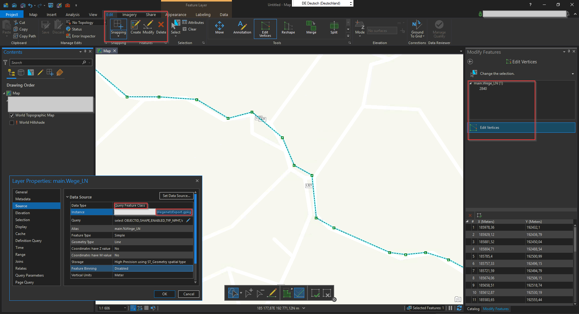
Good news for all users and fans of Geopackage – with ArcGIS 2.6 ESRI made it possible to edit features stored in a geopackage database directly 🙂 So after QGIS making geopackage it’s default “geodatabase”, ESRI also supports it including editing features.
I did a first workflow and ArcGIS Pro 2.6 did it’s job editing features stored in a geopackage 🙂
ArcGIS Pro 2.6 allows editing Geopackage geometries
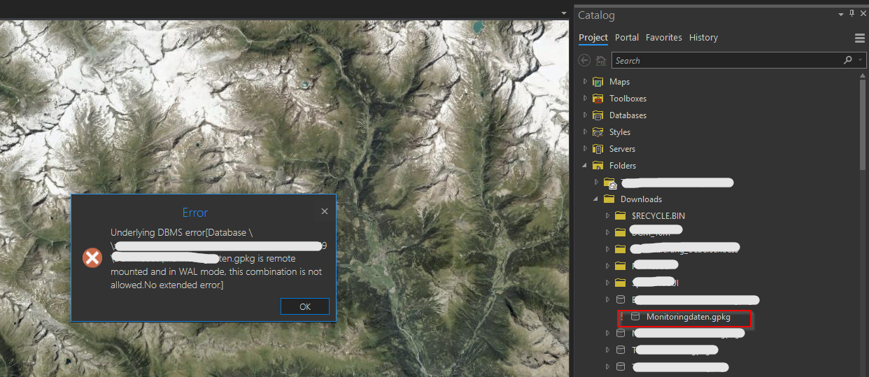
Normally opening a geopackage in ArcGIS Pro (2.3.0) works fine, but recently I came across a new “nice” error-message: “Underlying DBMS error… gpkg is remote mounted and in WAL-mode“.
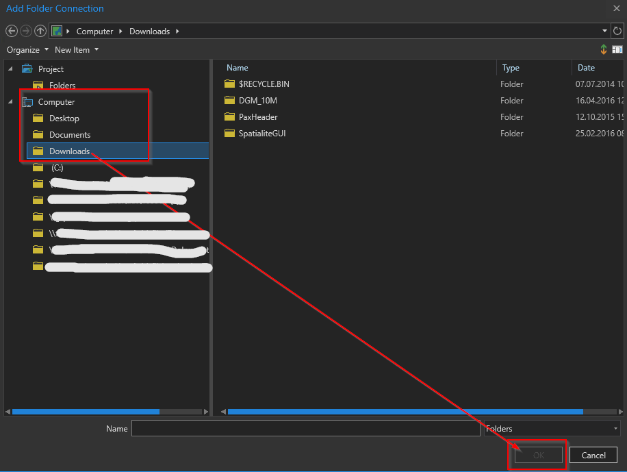
Sometimes creating a folder-connection in ArcGIS Pro (V 2.2.3) can be tricky or not possible at first glance. System-defined folders (folder links) like Documents, Downloads, Pictures etc. on the left side of the connection dialog can’t be used (“OK”-button disabled).
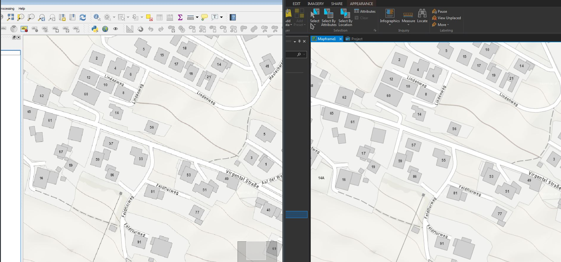
Using the WMTS-Service basemap.at in ESRI ArcGIS Pro (v 1.4) and QGIS (v 2.18) I discovered some differences in the display-quality of the WMTS-Service in both programs – while basemap.at was a beauty in ArcGIS Pro, the display-quality in QGIS was not that smooth… (@same extent etc.)
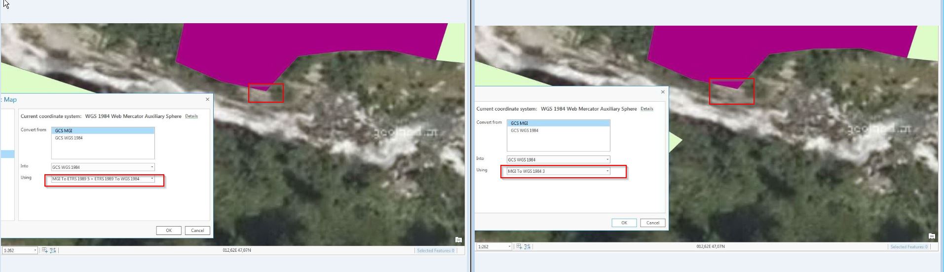
Nachdem ArcGIS Pro von ESRI erwachsen wird und sukzessive vermehrt im GIS-Alltag zum Einsatz kommt, anbei ergänzend zur Serie zur Anwendung bestmöglicher Transformationsparameter zwischen dem österreichischen Bundesmeldenetz und WGS84/ETRS89 die Implementierung dieser in ArcGIS Pro (Stand Version 1.3.1).
Transformation EPSG1618 (Position Vector) versus NTv2 AT_GIS_GRID – ein kleiner Unterschied